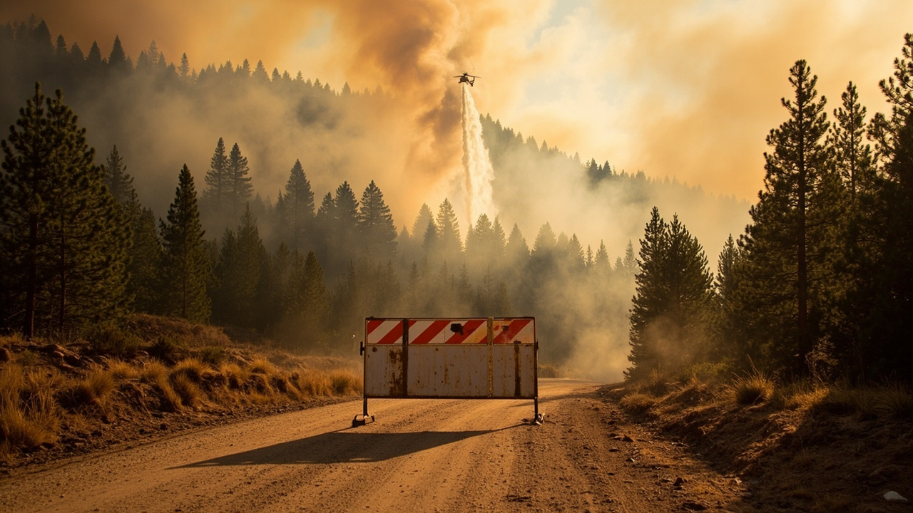
TL;DR: A lightning-sparked one-acre fire near Jackson Creek Road and Rampart Range Road triggered a 3-mile evacuation warning covering Devils Head Recreation Area on June 20, 2026, and the warning was lifted that same evening after crews stopped forward progress.
Warning covered 3-mile radius on Saturday evening
Officials in Douglas County, Colorado, issued an evacuation warning shortly before 6 p.m. on Saturday, June 20, 2026, for a roughly three-mile radius around a wildfire near Jackson Creek Road and Rampart Range Road, according to KDVR.
The warning zone included the Devils Head Recreation Area, southwest of Castle Rock and northeast of Deckers, an area popular with hikers, campers and day-use visitors.
What that warning meant mattered for anyone outdoors. A warning is not an order to leave immediately, but officials said it signaled potentially life- and property-threatening danger, according to KDVR.
People who might need extra time to get out, including those with pets or livestock, were urged to consider leaving right away, according to KRDO. Residents nearby were told to stay alert, avoid the area and be prepared to evacuate if conditions worsened.
Road closures were put in place at South Platte River Road and South County Highway 67/Sugar Creek Road while crews worked, according to CBS Colorado. That closure pairing was reported consistently across local updates at about 6:18 p.m.
The Douglas County Sheriff's Office led initial public messaging on social media and through local newsrooms, and the Douglas County Office of Emergency Management maintains background guidance on the difference between evacuation orders and warnings.
Fire identified as the Log Jumper Fire
The incident was named the Log Jumper Fire, located off Log Jumper Trail near Jackson Creek Road and Rampart Range Road, according to The Denver Post.
The fire broke out Saturday evening in the southern part of Douglas County, in the Sedalia-area forest corridor served by local and federal responders, according to the Denver Gazette.
Early reports described fire crews on scene with a helicopter dropping water on the fire, according to KRDO. Later summaries added detail on aviation support.
One Type-3 helicopter with Monument Helitack and one Type-2 helicopter with Douglas County assisted with water drops, according to CBS Colorado.
For backcountry travelers, the takeaway is direct: even a small start near a trailhead or recreation area can trigger a wide precautionary zone. A three-mile radius covers far more ground than most hikers can exit quickly on foot, especially with children, dogs, or heavy packs.
Officials encouraged residents to keep essential items accessible, have an evacuation plan ready and continue monitoring official sources for updates, according to KDVR.
The sheriff's office also encouraged residents to sign up for emergency notifications through DougCo Alerts, according to the Denver Gazette.
Warning lifted same night as progress stopped
The evacuation warning was lifted Saturday evening as firefighters made progress, with local newsrooms reporting lift times between about 7 p.m. and later in the evening as updates moved through official channels, according to Denver7.
CBS Colorado reported the warning was lifted around 7 p.m. as crews continued work toward containment. KKTV reported that as of 7:45 p.m., the U.S. Forest Service said evacuation warnings had been lifted and estimated the fire at one acre and 80% contained. KRDO reported the formal lift logged at 8:19 p.m. in the southern part of the county.
Despite the different timestamps on fast-moving update posts, the operational message was consistent: the precautionary zone did not become a mandatory evacuation, and people were not ordered out under force.
By about 8 p.m., forward progress on the fire had stopped and the fire was approximately 80% contained, according to CBS Colorado. Denver7 similarly reported the fire was 80% contained with forward progress stopped just before 7 p.m., citing the Douglas County Sheriff's Office.
An earlier evening update cited by The Denver Post had placed containment lower while crews were still actively working, which reflects how containment figures rise during initial attack. The later 80% figure became the widely repeated status Saturday night.
Command of the incident was transferred to the Forest Service after the initial county-led response, according to CBS Colorado.
One acre, one tree, one lightning strike
The Log Jumper Fire never grew more than an acre, according to KRDO. Multiple outlets estimated the final footprint at around one acre.
Authorities believe the fire was caused by a lightning strike that ignited a tree, according to CBS Colorado. The Denver Gazette likewise reported a lightning strike that ignited a tree as the cause.
No one was injured by the fire, according to KRDO.
Many areas of Colorado were experiencing moderate to severe drought at the time, and dry conditions had created high fire danger in parts of the state, according to CBS Colorado.
For survival readers, drought context is important. A single tree strike can produce visible smoke quickly, but in dry forest it can also throw embers into needle litter and deadfall. That is why agencies treat even a one-acre start seriously when it sits near recreation traffic and limited-access dirt roads.
The West Douglas County Fire Protection District placed the Log Jumper Fire at around one acre in size, according to Denver7.
Why early detection changed the outcome
The Douglas County Sheriff's Office credited Pano-AI cameras and an alert resident in the area with a lightning-quick response that prevented the fire from getting out of control, according to KRDO.
The Denver Gazette reported the fire was detected within moments due to an alert resident and Pano-AI cameras that captured smoke rising from the area. The sheriff's office said early detection and rapid response allowed firefighters to quickly stop the fire's forward progress.
Pano-type camera networks are fixed forest cameras that scan for smoke. When paired with a human report, they can help dispatchers confirm location faster than a single 911 call alone.
That speed shaped the tactics. Ground crews could engage while helicopters worked the small perimeter, rather than arriving after the fire had spotted across a road or trail.
Multiple agencies assisted, including the Douglas County Sheriff's Office, the Douglas County Office of Emergency Management, Douglas County Helitack, Monument Helitack, West Douglas Fire Protection District, South Metro Fire Rescue and the U.S. Forest Service, according to CBS Colorado.
For hikers and dispersed campers, the lesson is not to rely on cameras. Carry a charged phone where coverage exists, know the road names at trailheads, and report smoke early with a landmark, trail name and direction of travel.
Readiness lessons for recreation-area evacuations
Treat a warning as time to move. Officials said people needing extra time, and those with pets or livestock, should consider leaving during a warning, according to KRDO. Waiting for an order can mean leaving in smoke, darkness or traffic.
Know the roads before you need them. The closures at South Platte River Road and South County Highway 67/Sugar Creek Road show how quickly forest access can narrow, according to CBS Colorado. Before parking at Devils Head or similar sites, note two exit directions.
Keep essentials accessible. Officials advised keeping essential items accessible and having an evacuation plan ready, according to KDVR. For day hikers, that means water, headlamp, map, medications and vehicle keys stay together rather than scattered at camp.
Avoid the area once crews arrive. Residents were encouraged to stay alert, avoid the area and be prepared to leave if conditions worsened, according to KDVR. Extra vehicles on narrow forest roads slow engines, water tenders and helicopter support operations.
Monitor official sources, not rumor. The sheriff's office updates moved through social posts and emergency alerts, and officials pointed residents toward DougCo Alerts for emergency notifications, according to the Denver Gazette. A weather radio or phone alert setting can matter when smoke degrades visibility and cell service is patchy.
No new orders were reported after the lift. The incident remained a warning-only event with stopped forward progress, high containment and a one-acre footprint by Saturday night.
Sources referenced
- UPDATE: Douglas County evacuation warning lifted | KRDO (https://krdo.com/news/top-stories/2026/06/20/evacuation-warning-issued-for-3-mile-radius-in-douglas-county/)
- Firefighters nearing containment of wildfire, evacuation warning lifted northeast of Deckers, Colorado - CBS Colorado (https://www.cbsnews.com/colorado/news/wildfire-evacuation-warning-northeast-deckers-colorado/)