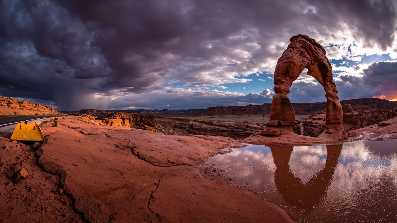
Flooding Forces Closure of Arches National Park's Most-Visited Trail
Heavy rainfall closed Delicate Arch Trail, the Wolfe Ranch parking lot, and the Delicate Arch Viewpoint road at Arches National Park on November 2, 2026 — and the Colorado River above Moab more than tripled in flow overnight, jumping from roughly 3,900 cubic feet per second to nearly 13,700 cubic feet per second, according to Moab Sun News.
The closures are part of a broader flooding emergency across southeastern Utah, where October rainfall reached four times the monthly average, compounding hazards on trails, roads, and river corridors throughout the region.
What Triggered the Shutdown
Significant water flow and erosion following the weekend's sustained downpours prompted Arches National Park officials to issue safety closures as a precautionary measure, according to KUTV. The National Park Service posted alerts warning visitors away from affected zones and directing them to verify weather conditions before arriving at the park.
The Wolfe Ranch parking lot — the primary staging area for the 3-mile round-trip hike to Delicate Arch — was included in the closure, effectively cutting off public access to the trail entirely. The Delicate Arch Viewpoint road remained blocked as of midday November 2, with crews working to clear debris from access routes.
Colorado River Surge: By the Numbers
The overnight hydrograph spike documented by Moab Sun News illustrates the speed at which desert flash floods develop. A river running at approximately 3,900 cubic feet per second before the storm crested near 13,700 cubic feet per second by the morning of November 2 — a more than threefold increase in hours.
That level of surge carries serious implications beyond the riverbank. Road crossings, low-water bridges, and canyon-bottom trails throughout Grand County become impassable or structurally compromised when water rises that quickly. Moab Sun News reported that the Moab region's flood tracker recorded the surge as part of the broader late-season storm system hitting the Colorado Plateau.
October Rainfall Context: Four Times the Norm
Southeastern Utah entered November already saturated. According to Moab Sun News, the region accumulated four times its normal monthly rainfall during October alone, leaving soils with little capacity to absorb additional moisture. When the November storm arrived, runoff moved rapidly into canyon drainages, wash systems, and ultimately into the Colorado River corridor.
This saturation context matters for outdoor travelers: trails that appear passable on clear-day photographs can become unstable, undercut, or submerged in hours when the upstream watershed is already at capacity. The slickrock surfaces characteristic of Arches — visually striking and normally grippy when dry — become dangerously slick after rainfall, a condition park rangers specifically flagged in their post-storm advisories.
Trail Reopening Status and Remaining Hazards
By midday November 2, the Delicate Arch Trail itself had partially reopened, according to KUTV. However, park rangers issued explicit cautions about slick rock surfaces and residual moisture throughout the hiking corridor. The Delicate Arch Viewpoint road remained closed as of that report, with no confirmed timeline for restoration.
The National Park Service advises visitors to check the Arches alerts page at nps.gov/arch/planyourvisit/conditions.htm before traveling. Road and trail status can shift rapidly during active weather events, and conditions that appear resolved at park headquarters may still be hazardous closer to the trailhead.
Regional Impact: Evacuations and Multi-County Warnings
The flooding extended well beyond Arches National Park's boundaries. Emergency services conducted evacuations in Bluff, a small town in San Juan County roughly 80 miles south of Moab, according to KUTV. The National Weather Service issued flood warnings covering San Juan County and neighboring jurisdictions, noting that additional rainfall could intensify an already stressed drainage system.
Local authorities repeated consistent messaging: do not attempt to drive through flooded roadways. Water depth on desert roads is notoriously difficult to judge visually, and moving floodwater can sweep vehicles off road surfaces at surprisingly shallow depths.
Gear and Preparedness Lessons for Desert Canyon Visitors
The Arches closure reinforces several preparedness principles relevant to any desert canyon environment. KUTV reported that park management directed visitors to check weather conditions and be ready for rapid changes — guidance that applies broadly across canyon country destinations.
Real-time river gauge data, such as that tracked by Moab Sun News in its flood tracker, is publicly available through the U.S. Geological Survey's water resources portal and can signal developing flood risk hours before conditions reach a trailhead. Hikers in canyon environments are well-served by bookmarking gauge data for drainages near their planned routes.
Slickrock conditions after rain also demand footwear with sticky rubber outsoles. Canyon trails in the Colorado Plateau transition from high-friction to nearly zero-friction surfaces within minutes of rainfall, a hazard that catches visitors accustomed to hiking on soil or gravel trails.
Communication devices — including satellite messengers — are particularly valuable in areas like Grand County where cellular coverage is sparse and storm development can be sudden. Checking in with a contact before and after a hike provides a safety net when conditions deteriorate faster than forecasts suggest.
Monitoring and Next Steps
Arches National Park officials stated they would continue monitoring weather updates and act as needed to maintain safe conditions across the trail system, according to KUTV. With further rainfall in the forecast at the time of the November 2 report, restoration timelines for the viewpoint road and full parking lot access remained contingent on both weather clearing and crew assessments of structural stability.
Visitors planning trips to Arches, Canyonlands, or other southeastern Utah destinations should treat the park's alerts page and the Moab Sun News flood tracker as essential pre-trip resources during the fall and spring seasons — the two periods when the Colorado Plateau is most vulnerable to rapid, high-volume precipitation events.
Sources referenced
- Flooding closes Delicate Arch Trail and viewpoints at Arches National Park (https://kutv.com/news/local/flooding-closes-delicate-arch-trail-and-viewpoints-at-arches-national-park)
- Moab Region Flood Tracker 2026 — Colorado River above Moab more than triples overnight (https://moabsunnews.com/2026/11/01/moab-region-flood-tracker-2026/)