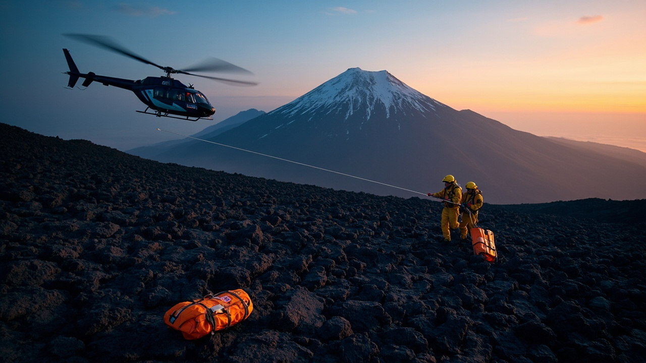
The newest Mount Jefferson-area rescue ended on Oct. 30, 2026, when a Marion County deputy followed barefoot prints through snow to a hiker lost four days near Breitenbush Lake — the same Cascades country where the Wildland Fire Lessons Learned Center's case study of a 2021 rescue drew three lessons: a shared radio group covering SAR and medical frequencies, joint drills with area partners, and medical practice after dark.
The Oct. 30 rescue near Breitenbush Lake
Marion County Forest Patrol Deputy Derrick Ramseyer spotted the prints while patrolling near Breitenbush Lake along the Pacific Crest Trail, the Statesman Journal reported. One track appeared barefoot, and the sheriff's office said he became concerned for the person's safety and followed them nearly five miles to Forest Service Road 4220, a rough, remote road along the Mount Jefferson Wilderness boundary. There he found a man wrapped in a sleeping bag. The man had been lost four days; a few inches of snow had fallen at higher elevations over the previous five days, the newspaper reported. Medics treated him for exposure in Detroit before he was taken to Santiam Hospital for frostbite and hypothermia. The sheriff's office credited Ramseyer's alertness with likely saving the man's life, and it urged hikers to carry an inReach or similar emergency communication device, adding that weather can change suddenly at higher elevations.
What the 2021 case involved
The center's post, "Mt. Jefferson Wilderness Search and Rescue," published Oct. 8, 2024, describes a fire crew pulled into a rescue. On July 18, 2021, the Siskiyou Rappel Crew's helicopter was staged at Sunriver Airport for wildland fire support when, at 2012 hours, the Jefferson County Sheriff's Office SAR Team requested search-and-rescue mutual aid. With daylight closing, the crew flew toward the last coordinates from the hiker's cell phone ping. An aerial search with a Jefferson County ground resource did not locate the hiker, so four rappellers were inserted to search on foot. No cargo went with them, and the rappel helicopter left.
At 2137 hours, two rappellers entered the lava field to limit exposure in extremely rough terrain. During the search they received the hiker's latitude and longitude from a Garmin InReach device, plus the hiker's name. Engine 640 from the Deschutes National Forest stood by with advanced medical supplies, alongside the other rappellers and SAR personnel, and the group set a PACE plan covering primary, alternate, contingency and emergency options.
The two rappellers located the hiker at 2157 hours after walking toward sounds of responses to their calls. The crew ordered a hoist-capable National Guard helicopter standing by in Klamath Falls while the remaining rappellers, one an advanced EMT, moved toward the patient with Engine 640's medical gear. The helicopter launched at 2256 hours, delivered its flight medic and hoisted the patient at 0049 hours before heading to St. Charles Medical Center. The diagnosis was dehydration and potential rhabdomyolysis. The rappellers walked back over the lava rocks and all resources exited via the Jefferson Creek trailhead without problems, the center reported.
The center's incident record places the rescue itself in the Deschutes National Forest's Sisters Ranger District, outside Sisters, Oregon, and classifies it as a medical or exertion incident.
Three procedural lessons
Crews should assemble a radio group for their response area that includes SAR and medical frequencies. They should bring area partners into a mutual-aid SAR simulation and use the exercise to surface and fix communication problems. And they should rehearse a medical scenario after dark.
Behind that list: InReach coordinates and the hiker's name reached the crew after rappellers were in the field, and the hoist came at 0049 hours.
Four more cases in 2026
Between May and October 2026, Oregon sheriff's offices reported at least four Mount Jefferson Wilderness-area search-and-rescue cases.
On May 14, the Linn County Sheriff's Office said Jerry Highsmith, 80, of Lebanon, had been found alive near Duffy Lake on a trail system, the Statesman Journal reported. He had been due back May 12 from a trip to Fir Lake that began May 10. The search drew more than 50 people, among them drone operators, K-9 teams, aircraft crews and ground searchers, and the sheriff's office said Highsmith showed symptoms of exposure and could not walk.
On July 9, searchers found John Nelson, 68, at about 8:42 p.m. in a deep drainage roughly five trail miles from Russell Lake, near the South Breitenbush Trail that has been closed since the 2020 wildfires, KATU reported. The retired medical doctor had left Russell Lake alone at about 7:15 a.m. on July 7, and a friend of the family reported him missing around midday, according to KTVZ. Earlier that day, Forest Service crews had cleared parts of the route, and more than 100 volunteers and partner agencies helped. An Oregon Army National Guard Black Hawk evacuated him to a landing zone around 11 a.m. on July 10.
On July 25, the Linn County Sheriff's Office said Jared John Empey, 37, of Kuna, Idaho, had fallen near the Red Saddle on Mount Jefferson. Based on witness observations, the office said the fall was not survivable. It said recovery efforts were continuing that day, though recovery might not be possible where he fell.
What the record supports for gear and planning
After Nelson's rescue, Marion County Sheriff's Sgt. Garrett Olson said hikers and campers should stay with a partner, let someone know their plans and carry a device that can send an emergency notification, such as a GPS communicator or beacon, KATU reported. "This incident is a reminder of how quickly conditions can change in remote wilderness areas," Olson said.
The Forest Service's Mount Jefferson Wilderness page lists 109,082 acres and 163 miles of trail, including 40 miles of the Pacific Crest Trail. It classes northern sections of the Summit Trail, along with the Sugar Pine Ridge, Minto Lake and Brush Creek trails, as impassable and not recommended, noting that hikers have reported getting lost while attempting to follow them from the west and that a few of those attempts ended in rescues. A Central Cascades Wilderness Permit is required for all overnight use and some day use between June 15 and Oct. 15, and campfires are barred above 5,700 feet.
What remains open
The Statesman Journal did not name the Oct. 30 hiker or describe how he became lost. After Nelson's rescue, KATU noted that details of his survival and how he became lost had not been released.