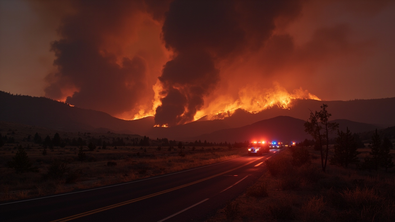
TL;DR: Four Washington fires prompted evacuations on June 15, 2026
Four wildfires burning across south-central Washington prompted evacuation orders over the weekend, with the Tule Road fire south of Toppenish reaching around 5,000 acres, the OIE fire near Benton City holding at around 500 acres after Level 3 orders were lowered to Level 2, and the Juniper Dunes and Twin Sisters fires each exceeding 3,600 acres with active evacuations near Hatch Grade, according to KOIN.
How the four-fire weekend developed
PORTLAND, Ore. coverage from KOIN, posted June 15, 2026 at 12:07 p.m. PDT, described wildfire season beginning around the Pacific Northwest with several large fires already burning in Washington. The report identified the Tule Road, OIE, Juniper Dunes and Twin Sisters incidents as the four active fires drawing response on Sunday. The Tri-City Herald, updated June 15, 2026 at 8:22 a.m., reported firefighters scrambling across Benton and Franklin counties and the western edge of Walla Walla County, with the start of summer still a week away. That timing matters for prepared adventurers because early-season grass, brush and stubble were already carrying fast-moving fire.
The Washington State Patrol said state fire assistance was mobilized for the OIE Fire under the Washington State Fire Services Resource Mobilization Plan in support of local firefighters working near Benton City in Benton County. Washington State Patrol Chief John Batiste authorized mobilization of state firefighting resources on June 14, 2026, at 6:00 p.m. at the request of Assistant Fire Chief Todd Dormaier of Benton County Fire District 2, according to the Washington State Patrol. Mobilization specialists from the Fire Protection Bureau ordered three wildland strike teams to aid containment, while State Fire Marshal's Office personnel worked both en route and remotely to coordinate dispatch, the agency said.
Tule Road fire south of Toppenish
The largest fire described by KOIN on Sunday night was the Tule Road fire south of Toppenish, sitting at around 5,000 acres. The same report stated the Tule Road fire did not have any evacuations in place at that time. No containment figure for Tule Road was included in that Sunday-night update. For backcountry travelers, the lack of an evacuation order did not mean lack of hazard, because the Tri-City Herald reported huge smoke plumes and raging flames from weekend fires were visible from as far away as Tri-Cities Airport in Pasco.
Outdoor readiness around a 5,000-acre grass-and-brush fire means treating nearby roads and trails as subject to sudden closure. The Washington State Patrol explained the mobilization plan exists to quickly notify, assemble and deploy fire service personnel, equipment and other resources from around the state when fires exceed local capacity. More information about that statewide coordination process is available at the agency's all-risk-mobilization page referenced by the Washington State Patrol.
OIE fire near Benton City and Old Inland Empire Highway
The OIE Fire started on June 14, 2026, at approximately 1:15 p.m., according to the Washington State Patrol. The agency estimated the fire at 500 acres and growing, burning in grass, brush and stubble. The fire threatened primary structures, power infrastructure, crops and a dam, the agency said. The cause was under investigation.
KOIN reported the OIE fire was burning near Benton City at around 500 acres. The station reported Level 3 evacuations were ordered on Sunday in the area, but those orders were later reduced to Level 2. Apple Valley News Now reported that at 10:05 p.m., all Level 3 evacuations had been reduced to Level 2 evacuations, with residents of the previously evacuated area able to return home if they chose but urged to remain cautious and prepared to leave if conditions escalated, per Benton County Emergency Services.
The Tri-City Herald reported Sunday afternoon residents were evacuated as fire burned near Old Inland Empire Highway just north of Interstate 82 in Benton County, in an area between Benton City and Prosser. The newspaper also reported the blaze knocked out power in Prosser. The American Red Cross said Sunday evening that an estimated 40 people had been forced to evacuate and one family home had burned down, according to the Tri-City Herald.
Apple Valley News Now listed Level 2 BE SET evacuations from the intersection of Rattery Road and Old Inland Empire Highway east to the intersection of West Knox Road, and from the intersection of North District Line Road and Hanks Road west to the intersection of North Case Road and south to Old Inland Empire Highway. A second Level 2 zone ran from the intersection of West Gibbon Road and North Hansen Road south to the Yakima River and north of Interstate 82, to include Island View PR Northwest and North Salmon Run PR Northwest and Hansen PR, according to Apple Valley News Now. The station also reported firefighters said forward progress had been halted as of about 9 p.m., with three wildland strike teams dispatched and Washington State Fire Marshal's Office personnel assisting containment.
The State Emergency Operations Center at Camp Murray was activated to Level 2, partial activation, to help coordinate state assistance for the OIE Fire, according to the Washington State Patrol. Utility crews worked to restore electricity as quickly and safely as possible, while fire crews remained in the area overnight to work hot spots and small brush fires, according to reports carried by NBC Right Now. Benton County Sheriff's Office statements carried in that coverage asked people to avoid the area and stay out of the incident zone so fire crews, law enforcement and EMS could move safely.
Juniper Dunes fire northeast of Pasco
The Southwest Washington Interagency Incident Management Team gave Sunday updates listing the Juniper Dunes fire at 3,627 acres and the Twin Sisters fire at 3,624 acres, respectively, according to KOIN. Earlier Sunday reporting from the Tri-City Herald described a rapidly growing incident in the Juniper Dunes recreation and wilderness areas northeast of Pasco, which had reached 600 acres according to the Western Fire Chiefs Association.
A number of fire trucks were dispatched to the Juniper Dunes fire just before 8 p.m. Saturday to near Kruse Road, west of the area popular with off-road vehicles, hikers and equestrians, according to the Tri-City Herald. By 10 p.m. Saturday the fire, fought with crews from Franklin County fire districts, had spread across about 100 acres. The fire chiefs association reported the fire burning mostly northeast of Juniper Dunes Road on Sunday, the newspaper said.
The fire also was fought Sunday from the air using water from the Snake River near Fishhook Park, according to the association as reported by the Tri-City Herald. About 3:30 p.m. Sunday the Southeast Washington Interagency Incident Management Team said incident management teams were arriving to help with fires burning in the Juniper Dunes area of Franklin County and near the Twin Sisters in Walla Walla County just across the Columbia River from Benton County, according to the Tri-City Herald.
The Juniper Dunes area totals about 19,000 acres, including wilderness covering more than 7,000 acres, as well as open recreational area and an area of critical habitat, according to the Tri-City Herald. For hikers, equestrians and off-road riders, that landscape of sand dunes and northernmost juniper trees offers limited shelter and few paved exits once smoke reduces visibility. Anyone with a planned trip to Juniper Dunes should treat a dispatch to Kruse Road and aerial water drops from the Snake River as a signal to cancel entry and select ground farther from Franklin County fire operations.
Twin Sisters and Highway 730 fire near Wallula
KOIN reported evacuations were in effect near the Twin Sisters fire, with some Level 3 evacuations in place near Hatch Grade and Level 1 evacuations from Port Kelley to the Oregon border. The Tri-City Herald reported two wildland strike teams were ordered to help local agencies contain the Highway 740 Fire in Walla Walla County near the Twin Sisters south of Wallula that started late Saturday.
Highway 730 was closed in both directions from Wallula Junction south to the Washington and Oregon state line about 11 p.m. Saturday night due to a crash, according to the Tri-City Herald. By early Sunday morning the Washington State Department of Transportation reported the closure was for a wildfire burning through grass, brush and crops, with lanes reopening about 3 p.m. No information was available on the weekend about whether the crash was connected to the fire, the newspaper said.
Homes were threatened by the fire and Walla Walla County Emergency Management reported evacuations in the Hatch Grade area south of the junction in effect starting early Sunday morning and continuing Sunday afternoon, according to the Tri-City Herald. Other residents near the fire were put on alert to be ready to evacuate. The Western Fire Chiefs Association showed fire burning across the state line into Umatilla County and aircraft being used to curb spreading flames, the newspaper said.
What evacuation levels mean for go-bags and vehicles
Level 3 means leave immediately, while Level 2 BE SET means residents should be prepared to leave and returning residents should remain cautious and prepared to leave if the situation escalates, as described by Benton County Emergency Services statements reported by Apple Valley News Now. The Benton County Sheriff's Office said several residences were lost in the OIE fire, without specifying how many homes were destroyed or identifying affected areas, according to NBC Right Now. The sheriff's office added its thoughts were with families and individuals impacted.
Survival readiness for Level 2 means keeping vehicles fueled, trailers hitched or ready, livestock plans set, prescription medication packed, and papers, chargers and water accessible near the door. The OIE evacuation geography shows why paper maps still belong in a go-bag, because orders referenced rural intersections including Rattery Road, Knox Road, District Line Road, Hanks Road, Case Road, Gibbon Road and Hansen Road rather than street addresses. Do not wait inside a Level 3 zone for confirmation, because emergency officials asked the public to stay out of the incident zone to keep routes open for fire, law enforcement and EMS vehicles.
Power, smoke and road hazards around the Columbia Basin
The Tri-City Herald reported power was knocked out in Prosser during the Benton County fire, while utility crews worked to restore service as fire operations continued. A home-power outage during wildfire response can disable well pumps, garage doors, air filtration and device charging the same night smoke degrades air quality. Keeping a battery-powered weather radio, headlamp, spare batteries and portable power bank with a packed vehicle reduces dependence on grid power after an evacuation order.
Highway closures added another hazard for travelers towing trailers or driving low-clearance vehicles through smoke. The Highway 730 closure from Wallula Junction to the state line lasted from late Saturday night until about 3 p.m. the next day before lanes reopened, according to the Tri-City Herald. Drivers should plan alternate routes that avoid river crossings and narrow rural roads near active perimeters around Benton City, Prosser, Wallula, Hatch Grade and Port Kelley, because fire first moved south toward Interstate 82 before jumping the Yakima River and turning north, according to Benton County Sheriff's Department statements reported by NBC Right Now.
Sources referenced
- WA wildfire season: Tule Road, OIE, Juniper Dunes, Twin Sisters see evacuations - KOIN (https://www.koin.com/news/wildfires/evacuations-underway-for-4-fires-burning-in-washington/)
- State Fire Mobilization Authorized for the OIE Fire - Washington State Patrol (https://wsp.wa.gov/state-fire-mobilization-authorized-for-the-oie-fire-2/)