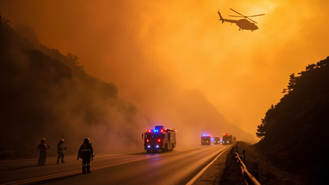
TL;DR: Avoid Big Sur as the Timber Fire and Plaskett Fire force evacuations and close Highway 1
TL;DR: Tourists should stay out of Big Sur while the Timber Fire burns above Highway 1 and a newer Plaskett Fire adds evacuations and a fresh Highway 1 closure.
Evacuation orders expanded along the Big Sur coast as the Timber Fire grew to nearly 2,500 acres by midday Tuesday, Aug. 11, 2026, with 5% containment, according to Timber Fire in Big Sur Forces Evacuations, Threatens Beloved Tourist Sites | KQED. Officials urged visitors to avoid the area so crews could protect homes near Highway 1 in the Ventana area and keep the road clear for emergency equipment and personnel.
By Thursday, Aug. 27, 2026, the situation escalated again, with the Timber Fire reported at more than 19,000 acres and 23% contained and Highway 1 closed once more, according to Highway 1 Closes Again as Big Sur Wildfires Grow, Tourists Urged to Stay Away | KQED. That later report described the Timber Fire as the third-largest in the state this year and reported a second blaze, the 50-acre Plaskett Fire at 0% containment south of the Timber Fire.
Where the Timber Fire started and how it spread
The Timber Fire broke out shortly after 9:30 p.m. Saturday in a remote area of grass and brush southeast of Loma Vista, according to Timber Fire in Big Sur Doubles Overnight, Forcing Evacuations of Popular Tourist Spots | KQED. It spread through Sunday in the Los Padres National Forest and burned actively overnight after fire behavior increased Sunday evening.
By Monday morning, Aug. 10, 2026, the fire had burned 800 acres and was 5% contained, according to the U.S. Forest Service as cited in that KQED report. The Forest Service said in a 10 a.m. Monday update that steep, rugged and difficult terrain continued to hamper firefighter access and suppression efforts.
Monday night into Tuesday, the blaze moved at a slow pace through grass, brush and oak woodland and remained active in northern and eastern directions. Ground crews Tuesday morning were working to reach difficult terrain and focused on protecting homes near Highway 1 in the Ventana area, according to Cal Fire as cited by KQED. The agency said the fire had held to the east side of the road as of Tuesday morning.
How big the fires became
The fire doubled in size overnight into Monday, then reached nearly 2,500 acres by midday Tuesday at 5% containment. Weeks later, after igniting earlier in August, the Timber Fire was still only 23% contained and had burned more than 19,000 acres of remote coastal terrain as of the Aug. 27, 2026 report.
Overnight into Thursday, Aug. 27, the Timber Fire pushed east and north deep into the Ventana Wilderness, according to a Cal Fire update cited in that later KQED report. The update identified critical fire weather as the primary driver of the fire.
A second fire, named the Plaskett Fire, broke out south of the Timber Fire in Monterey County around 11 a.m. Wednesday, Aug. 26, 2026. As of Thursday, the new fire was 50 acres and 0% contained and prompted additional evacuations.
Evacuation orders and warnings in Monterey County
Zones near Partington Ridge Road and North Coast Ridge Road — MRY-F026 and MRY-F027 — were evacuated Sunday night. Zones directly adjacent, MRY-F025 and MRY-F028-A, were evacuated throughout the day Monday. People living in MRY-F023 were ordered to leave Tuesday. In total, Cal Fire said just under 260 structures were threatened.
Additional surrounding areas — MRY-F022, MRY-F024, MRY-F028-B and MRY-F029 — were under evacuation warnings. Monterey County officials described a warning as the step before an order and a signal that residents may need to evacuate soon.
Late Monday, just after 11 p.m., the Monterey County Sheriff's Office issued evacuation warnings for three more zones, MRY-F024, MRY-F025 and MRY-F028, to the immediate north and south of existing orders along the Big Sur coast. By the Aug. 27 phase, Monterey County officials implemented new evacuation orders Thursday afternoon amid new fire growth Wednesday and planned critical backburning operations Thursday to remove fuels and stop forward progress.
Tourist sites, hotels and restaurants affected
The area under immediate evacuation orders included luxury resort the Ventana Inn, restaurant Nepenthe and the Henry Miller Memorial Library. Later coverage also listed Deetjen's Big Sur Inn and the Alila Ventana hotel and campground among hotels where guests were evacuated, and Nepenthe among businesses forced to close on and around Highway 1.
Meredith Gafill, whose husband and son run Nepenthe overlooking the Pacific Ocean, said smoke was visible from the patio and flames later that night. She said she had lived in Big Sur for 30 years and that her home and restaurant had been close to many fires. Gafill said the family lives on the restaurant property, which includes about 30 units housing employees on the remote cliffside.
Gafill said she and her husband had stayed onsite during past fires, but during the August fire week she stayed at a home they recently purchased in Monterey. She said the Monterey location gave her daughter-in-law a place to bring a pet, noting that evacuation notices often leave people without somewhere to go.
Kate Novoa, who lives in southern Big Sur far from the evacuation area, said she could see Partington Ridge shrouded in smoke from home and flames at times with binoculars. Novoa, who has chronicled area fires online for years, said the Timber Fire's movement reminded her and neighbors of the 2008 Basin Complex Fire, which burned more than 162,000 acres of Los Padres National Forest almost 20 years ago. She said once fire enters wilderness, as occurred Sunday afternoon, local residents with fire experience expect a long, extended fight because the country is so rugged.
Big Sur State Parks closed
On Monday, Monterey County closed all Big Sur State Parks, including Andrew Molera, Julia Pfeiffer Burns, Pfeiffer Big Sur and Point Sur. The Henry Miller Memorial Library announced a temporary closure on Instagram and wrote, "We implore you: Do not come to Big Sur." The library called the situation incredibly serious and said fewer cars allow Cal Fire and emergency services to work as effectively and safely as possible.
Some businesses had begun reopening and welcoming visitors back the prior week, including the Henry Miller Memorial Library and Nepenthe Restaurant. Aengus Wagner, wine and service director for Nepenthe, said the restaurant had just reopened Aug. 20 after being closed for 10 days during the initial outbreak. The restaurant then closed again at least through Sunday, Aug. 30. Wagner said closing twice in a month during the busiest month was difficult for employees collecting income for winter.
After reopening briefly, all state parks in Big Sur — Andrew Molera, Julia Pfeiffer Burns, Pfeiffer Big Sur and Point Sur — closed once again because of the Timber Fire threat.
Highway 1 status and alternate routes
Highway 1 remained accessible during the early phase, but the sheriff's office asked the public to keep roadways clear for first responders. The office wrote on social media that unnecessary traffic and sightseeing in the fire zone create hazards for emergency crews and slow critical operations.
On Monday, signs informed motorists the route was closed to all drivers except residents and employees between Point Sur Lighthouse and Julia Pfeiffer Burns State Park. Highway 1 was open to the public Tuesday morning, but Caltrans spokesperson Kevin Drabinski told KQED the agency still asked travelers to avoid Big Sur because of the fire's proximity to the highway and the inordinate amount of equipment and staffing required. Drabinski said the agency wanted as much highway space as possible left for emergency responders.
On Tuesday afternoon, Monterey California Highway Patrol announced on Facebook that Highway 1 was closed between Fernwood Resort and Campground and Julia Pfeiffer Burns Vista Point. On Wednesday afternoon, Aug. 26, Monterey CHP announced Highway 1 would close starting at 1 p.m. Thursday from just south of Andrew Molera State Park to the north and Deetjens Big Sur Inn to the south.
Caltrans spokesperson Kevin Drabinski said the agency asked people driving during the fire period to use alternate routes because responders were transporting large amounts of equipment and personnel along the road just below the fire. Regional tourism body See Monterey said travelers heading to Monterey from the south who planned to use Highway 1 should consider Highway 101 North. KQED noted that Nacimiento-Fergusson Road, connecting Big Sur south of Lucia to Highway 101 over the Santa Lucia mountains, is narrow, steep and winding.
Weather, smoke, fog and fire behavior
Residents said heavy fog helped keep the fire close to the ground and reduced wind. The same condition made helicopter access to water below the fog line challenging and prevented planes from dropping over flames.
Cal Fire said warmer and drier conditions were expected over eastern portions of the fire. For Wednesday afternoon and evening, there was a 15% chance of showers and thunderstorms. On Thursday, Aug. 27, the National Weather Service issued a Red Flag Warning for Friday morning, anticipating lightning amid isolated thunderstorms and winds up to 50 miles per hour. The agency said lightning strikes may result in new fire ignitions.
Car Week travel and visitor guidance
The fire came during busy tourist season for Highway 1, as travelers moved from Southern California to Monterey's annual car week, which began Friday, Aug. 7, 2026. Organizers say Monterey Car Week draws over 100,000 visitors every year and ran north of Big Sur through Sunday. See Monterey encouraged southern travelers to consider Highway 101 North instead of Highway 1.
The fire could affect the Pebble Beach Tour d'Elegance, which traditionally traces the coast from Pebble Beach to Big Sur. Organizers announced Tuesday they developed a contingency plan for the Thursday event, planning an alternate route to protect spectators and participants and give first responders space for essential work.
Visitors with existing Big Sur plans were advised to watch for email or voicemail from hotels about cancellations and options. KQED noted cellphone service in the area is spotty and that some properties may have been directly affected by evacuations. See Monterey advised visitors already in affected areas to follow evacuation instructions, take essential belongings and medications, and bring pets. According to See Monterey, several Monterey County hotels offered evacuation rates through a spreadsheet of available lodgings. Monterey County established a temporary evacuation point at Carmel Middle School for information and help on next steps.
Assemblymember Dawn Addis, D-Morro Bay, said she was communicating with local, state and federal partners. In a Monday statement, she said safety was the top priority, asked people to follow evacuation orders and guidance, and thanked firefighters, emergency responders and public safety professionals working around the clock.